
Surveyors & Consultants
Convert survey data into detailed and accurate site maps within hours to improve projects.
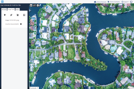
Get StartedThe gIntelligence Platform for Surveyors & Consultants
Get survey data processed into models faster with cloud-based processing. Map sharing and annotation tools make it easy to collaborate with clients. Use built-in measurement and collaboration tools to support better and faster decisions.
Easy-to-Use Tools
Use available in-viewer tools to calculate acreage, square footage, property depth and width, elevations, volumetric measurements and more.
Improved Accuracy
Use Ground Control Points to add accuracy and precision to survey models.
Increased Safety
Drone mapping helps you easily and safely visualize sites no matter where you are. The powerful inspection tool helps identify danger zones without having to walk them.